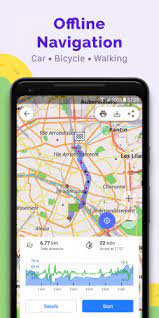
OsmAnd+ Offline Maps + Navigation v4.0.8 unlocked
armeabi-v7a
arm64-v8a
x86
x86_x64
331 MB - Clud Mega
Mod Info:
OsmAnd Live / Paid features unlocked;
Disabled / Removed unwanted Permissions + Receivers + Providers + Services;
Optimized and zipaligned graphics and cleaned resources for fast load;
Debug code removed;
AOSP compatible mode;
Languages: Full Multi Languages;
CPUs: armeabi-v7a, arm64-v8a, x86, x86_64;
Screen DPIs: 160dpi, 240dpi, 320dpi, 480dpi, 640dpi;
Original package signature changed;
Osmand is opensource navigation application with raster/vector maps
Osmand+ is an open source navigation application with access to a wide variety of global open street map data. All map data (vector or tile maps) can be stored on the phone memory card for offline usage. Osmand also offers offline and online routing functionality including voice guidance.
Osmand+ is the paid application version, by buying it you support the project, fund the development of new features, and receive the latest updates.
Some of the core features:
– Complete offline functionality (store downloaded vector or tile maps in a selectable folder)
– Compact offline vector maps for the whole world available
– Unlimited downloading of country or region maps directly from the app
– Offline Wikipedia feature (download Wikipedia POIs), great for sightseeing
– Overlay of several map layers possible, like GPX or navigation tracks, Points of Interest, favorites, contour lines, public transportation stops, additional maps with customizable transparency
– Offline search for addresses and places (POIs)
– Offline routing for short distances (experimental)
– Car, bicycle, and pedestrian modes with:
– Optional automated day/night view switching
– Optional speed-dependent map zooming
– Optional map alignment according to compass or direction of motion
What’s New:
• Cloud backup
• Added night mode for “Topo” rendering style
• Added option to download Contour lines in feet
• Tracks can now be colored by altitude, speed, or slope.
• Updated “Trip recording” dialog
• Distance by tap moved from the Radius ruler into a separate option
• Plan Route: added ability to change navigation options, accessing configure map and search without leaving plan route
• Added option to change the route line appearance.

* Comment obtenir le lien de téléchargement ?
* How do I get the download link?
 viewtopic.php?f=222&t=9976
* Vous êtes un visiteur? Comment s'inscrire sur ce forum
* You are a visitor? How to register on this forum
 viewtopic.php?f=77&t=296

